Amelia.
A life within ancient walls.
In southern Umbria, in the province of Terni, Amelia preserves the traces of ancient Ameria: stone walls, winding lanes, green hills and the memories of people who have called this place home.
Our journey begins with Amelia and moves through nearby towns and villages. History provides the setting; daily life and personal testimony give each place its voice.

Seven places, one shared landscape
Each chapter belongs to this single Stadia Vitae page. They are not separate WordPress pages: choose a name below to move directly to its story. Porchiano del Monte is a village within the municipality of Amelia; the other places have their own municipal administrations.
A town shaped by centuries
Before it was known as Amelia, the settlement was called Ameria. Ancient tradition described an exceptionally early foundation, but legendary dates should not be confused with archaeological proof. What survives is the evidence of a long settlement history, grounded in the defensive advantages of the hill and in connections with the surrounding valleys.
Roman Ameria belonged to an important regional network of routes, including the Via Amerina. Medieval and Renaissance developments added churches, civic buildings, residential streets and the quieter architecture of daily life. Rather than belonging to one period, Amelia presents several historical layers in the same walk.
To understand these layers, begin with its gates, follow the enclosed streets toward the historic centre and look beyond the best-known monuments. The proportions of a doorway, the stone steps of a side lane and the position of a shop can reveal as much about a place as its major buildings.
Walls, cisterns and the bronze Germanicus

The polygonal walls are among Amelia’s best-known landmarks. Their large, precisely fitted stone blocks still shape the approach to the historical centre. They also provide an immediate sense of the community’s long relationship with defence, terrain and the craftsmanship of stone.
Less visible is the extensive Roman cistern beneath Piazza Matteotti. It reminds us that an ancient town was not built from monuments alone: water management, storage and infrastructure were essential to everyday survival.
The archaeological museum preserves one of Amelia’s most celebrated discoveries, a remarkable bronze statue of Germanicus. Placed alongside the city’s architecture, this work invites a broader view of Ameria’s connections with the Roman world.
See the regional guide to Amelia ↗ and the Ministry of Culture’s cistern page ↗.
Amelia · Archaeology and art
The Archaeological Museum: treasures of ancient Ameria
Housed in the former Collegio Boccarini, a building with roots in a medieval Franciscan convent, the “Edilberto Rosa” Civic Archaeological Museum and Art Gallery brings together evidence of Amelia’s history from its pre-Roman origins to later centuries. Its collections are arranged across three levels.
The bronze Germanicus
The museum’s celebrated centrepiece is a bronze statue of the Roman commander Germanicus, more than two metres tall, discovered near Amelia’s Porta Romana in 1963. His richly decorated military armour makes the sculpture an outstanding witness to Roman art.
Pre-Roman burial treasures
Grave goods from the ancient necropolis found in the former Consorzio Agrario area shed light on the people of Ameria before full Roman rule, including their customs, possessions and connections with the wider Mediterranean world.
Roman inscriptions and sculpture
Funerary monuments, inscriptions, decorated architectural fragments and a capital bearing military trophies reveal the city’s place in Roman society. Some inscriptions recall prominent local families, including the gens Roscia.
Art Gallery: Saint Anthony Abbot
A highlight of the painting collection is Saint Anthony Abbot, a panel by the Renaissance artist Piermatteo d’Amelia. The gallery also presents works from churches and historic buildings of the surrounding area.
Multimedia presentations add context to Germanicus and to the life of ancient Roman Ameria, connecting the objects with the streets and landscape of the town visitors see today.
Explore further: Amelia Musei – official museum guide · Italian Ministry of Culture
Amelia · Places and memories
Lo Scoglio dell’Aquilone: a restaurant in the town’s social history
Situated at Via Orvieto 23, in the green landscape outside Amelia, Lo Scoglio dell’Aquilone was known as a restaurant and hospitality venue for weddings, celebrations and gatherings. Photographs of its dining rooms preserve a glimpse of the occasions that brought people together there.
Its history is also recorded in a postcard preserved by the Fondazione Carit under the title “Albergo Ristorante Scoglio dell’Aquilone da Nazzareno”. That archival record gives a tangible link to the establishment’s earlier identity and to the name by which it was remembered locally.
In December 2023, the regional newspaper Il Messaggero reported the restaurant’s closure as the end of a chapter in Amelia’s local history. The report is a historical milestone, not a verification of the property’s present operating status.
Historical references: Fondazione Carit – historic postcard · Photographs of the venue · Turismo Amelia – historic listing
The Cathedral: art, bells and a childhood memory
The Concattedrale di Santa Firmina is both a major landmark and a place with deep connections to the rhythms of community life. Four photographs show its exterior, nave, decorated vault and a pipe organ.
High above the historic streets, the Cathedral has watched generations of Amelia’s residents pass through the hilltop. The present building reflects, in particular, rebuilding after a devastating fire in 1629. Its interior brings together architecture, chapels, painted decoration and a long history of religious and artistic patronage.
Beside the Cathedral stands its unusual twelve-sided bell tower, dating from the medieval period. The tower is more than a silhouette in the city’s skyline. For a child growing up in Amelia, it could also be the setting of a Sunday adventure, long remembered for its sound.
The photographs below are personal contributions to the Stadia Vitae archive. They have been gently refined for clarity, but their content has not been reconstructed.
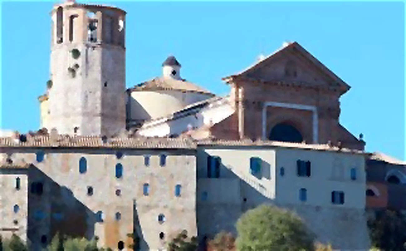
Sunday, up in the bell tower
“When I was a child, I used to climb the Cathedral tower on Sundays, all the way to the level where the bells were installed. One of them was enormous. I wanted to hear it ring from close by, and when it did, the sound seemed to fill the entire tower. The force of the vibration was unforgettable.
At the time, it felt like a little adventure. Only later did I think about the danger, especially to one’s hearing, of standing so close to a bell in motion. Yet that sound remains among my clearest childhood memories of Amelia.”
First-person childhood memory shared for Stadia Vitae. This is not an invitation to enter the bell chamber when bells are operating: intense sound can damage hearing.
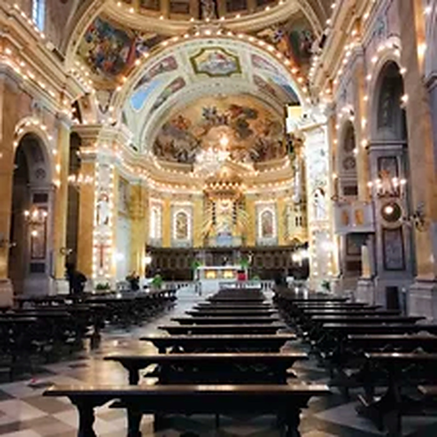
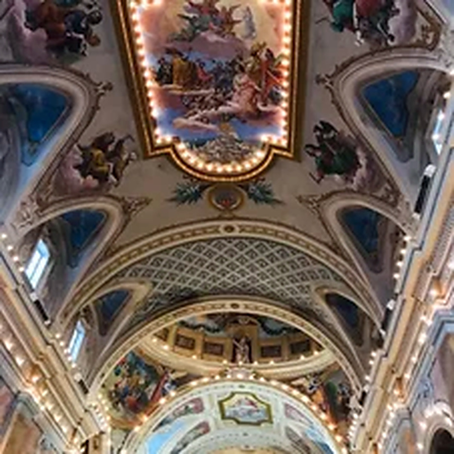
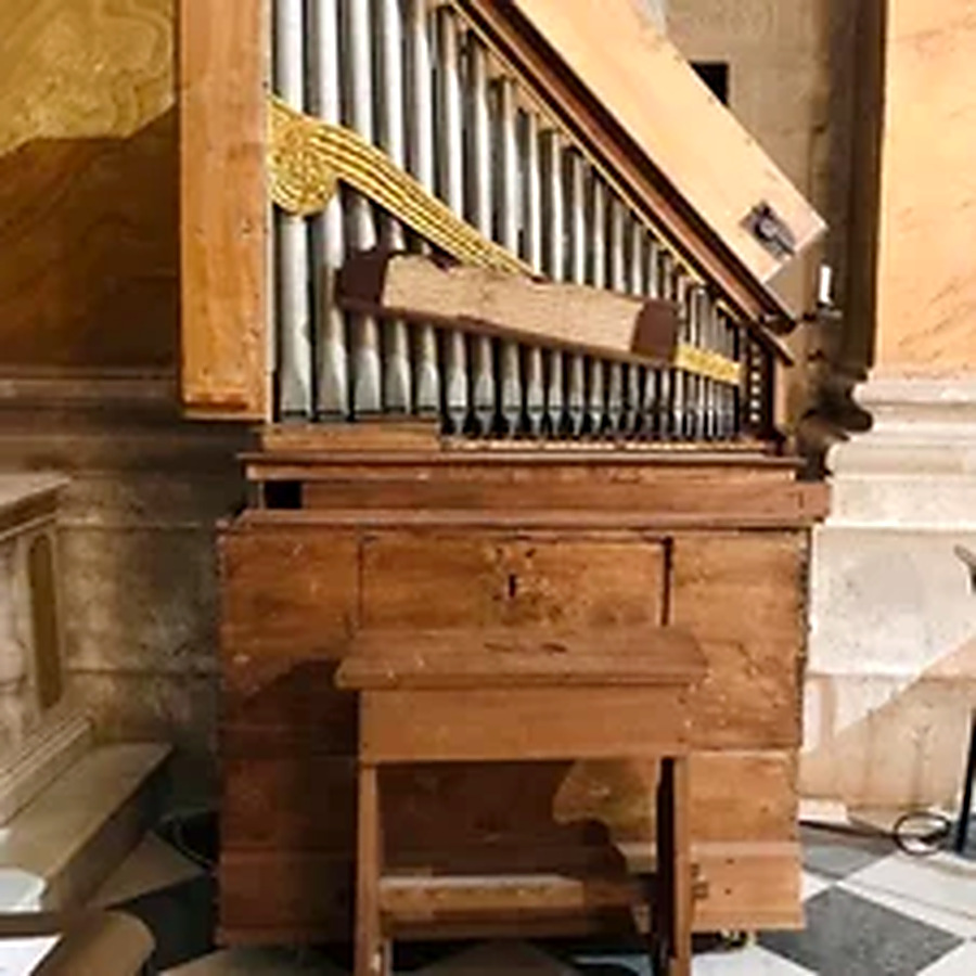
Historical reference: Diocese of Terni-Narni-Amelia — Concattedrale di Santa Firmina ↗. The bell-tower episode is personal testimony, not an archival record.
Beyond the postcard
The history of a small town lives in more than buildings. Streets, businesses, celebrations and family traditions make it recognisable to those who belong to it.
Shops and crafts
Local shops help record changes in how people work, shop and meet. We hope to add memories of workshops, market days, artisans and businesses from different decades.
Celebrations
The Palio dei Colombi connects Amelia’s districts and historic traditions. First-hand photographs and stories can give the celebration a human dimension alongside its historical background.
Villages and hamlets
Amelia’s territory reaches beyond the walled centre. Places including Fornole, Foce, Montecampano, Macchie, Collicello and Porchiano del Monte are essential parts of its identity.
Flavours of the Amerino hills
Olive groves, small farms and local food traditions belong in the same story as Amelia’s walls and churches.
Fichi Girotti
A long-established local speciality made with prepared figs and fillings that may include nuts and chocolate. Its history links food, craftsmanship and the life of the town.
Fava Cottòra
A traditional local bean that helps tell the story of small-scale agriculture and the preservation of culinary biodiversity in the Amerino area.
Olive oil and landscape
Olive groves help define the surrounding hills. The work of growers and mills offers a way to explore the continuity and transformation of rural life.
Narni.
A city above the river, with another city below
Narni stands over the Nera valley, where ancient roads and medieval civic power still shape the landscape. Its streets tell one story; the underground spaces tell another.

Known to the Romans as Narnia, the settlement occupied a strategic position above the Nera valley. Remains of the Bridge of Augustus recall the Via Flaminia and the engineering ambitions of Roman Italy. Later periods added defensive walls, churches, palaces and the imposing Albornoz fortress.
Narni rewards a slower kind of visit. Piazza dei Priori is not only a setting of impressive civic architecture: it is part of the town’s continuing social life. Nearby streets lead to the Cathedral of San Giovenale, the Palazzo Eroli museum and viewpoints over the river landscape. Details of masonry and the way streets adapt to the ridge reveal how the city evolved.
The best-known hidden chapter is Narni Sotterranea. Spaces discovered in 1979 beneath the historic centre include a small medieval church with painted decoration, chambers associated with the former Inquisition and other material evidence of the town’s long life underground. These spaces are documented, not legends invented for visitors.
The Roman city
From Nequinum to Roman Narnia, the ancient road system connected the area with wider Italy.
Civic and sacred spaces
The Cathedral, Piazza dei Priori and medieval fortifications remain reference points for town life.
A hidden history
Underground rooms preserve successive layers of worship, confinement and reuse.
Historical and cultural references: Umbria Tourism — Narni ↗ · Turismo Narni — Places to visit ↗ · Ministry of Culture — Narni Sotterranea ↗
Porchiano del Monte.
A small hilltop village with a long memory
Only a short distance from Amelia, Porchiano del Monte looks over the Tiber valley. Its compact medieval streets reveal how an apparently quiet village once stood at the centre of rival territorial ambitions.
Porchiano del Monte is part of the municipality of Amelia, not a separate province or town administration. Its historical documents record the name Fortiano, reflecting its fortified character. The defensive position above the valley gave a small settlement political importance beyond its size.
During the later Middle Ages, Porchiano was contested by powers including Amelia, Todi and neighbouring feudal lords. Its history is closely connected with the military leader Bartolomeo d’Alviano. These events were not merely episodes involving distant rulers; they affected walls, property, fields and the security of people living nearby.
Today the old entrance, narrow stone lanes and the churches form a setting for quieter observation. The Church of Santa Cristina, outside the walls, has notable painted decoration, while the historic church of San Simeone remains connected to parish life. Paths into nearby woodland and the Tiber-side countryside add a different side of the village’s identity.

Fortified origins
The village’s elevated site and surviving gateway reflect centuries of territorial defence.
Santa Cristina
The church outside the walls is notable for its location and painted apse.
Beyond the walls
Traditional paths, woodland and rural landscapes connect the settlement to the wider Amerino.
Historical and cultural references: Turismo Amelia — Porchiano del Monte ↗
Attigliano.
A terrace over the Tiber valley
Near the border with Lazio, Attigliano occupies an important position above the Tiber. Although its old castle is partly lost, the village still preserves powerful signs of its medieval history.

Attigliano’s elevated position made it attractive as a lookout and defensive site. Long before modern roads and rail connections, the river valley was an axis of movement, trade and control. The remains of castle walls, towers and its entrance still express the importance of this strategic place.
Piazza della Rocca is a good place to begin understanding the old settlement. The clock tower, once part of the defensive complex, carries an unusual single-handed clock with a twelve-hour dial. Nearby, the Fontana dei Delfini, created in 1885, belongs to the more recent civic landscape. These details remind us that even a small square can bring together several historical periods.
The fortunes of Attigliano were linked to noble families and regional conflicts, including the Alviano and Farnese. Yet the village also has a less monumental history: the work of those who lived beside the Tiber, changes in transport, the use of the main square and the experience of those who left or returned.
The castle remains
The surviving gate and defensive fragments still define the historical identity of the village.
A distinctive clock
A single-hand clock is one of the unusual features of the tower above Piazza della Rocca.
A meeting place
The square and the nineteenth-century Dolphin Fountain are part of local civic memory.
Historical and cultural references: Umbria Tourism — Attigliano ↗ · Italia.it — Attigliano ↗
Lugnano in Teverina.
Romanesque stone and a living village
Lugnano in Teverina rises among the hills near the river. Its stone houses and medieval layout draw the eye, but the centre of its architectural story is the remarkable Collegiata of Santa Maria Assunta.
Lugnano’s history is linked to the relationship between fertile lowland and defensible hilltop. Archaeological finds in the surrounding territory testify to Roman settlement; over time, the elevated village became a more important place to live, while its position attracted competing political claims.
The Collegiata di Santa Maria Assunta is among the most striking Romanesque churches in this area. Its façade and arcaded porch give the historic square a memorable character. The building was shaped over centuries, and the religious architecture also tells a civic story: churches were settings for community meetings, formal acts and local identity.
The village’s quieter streets, stone details and surrounding agricultural land provide a link between the monumental and the everyday. A chapter about Lugnano should listen as carefully to its residents as it looks at its buildings: how do seasonal celebrations, small businesses and inherited traditions keep the place alive?

The Collegiata
The Romanesque porch and façade have long made Santa Maria Assunta the village’s visual landmark.
Roman traces
The countryside includes archaeological evidence of Roman-era settlement.
Community traditions
Photographs and testimony can show how festivals, crafts and everyday life have evolved.
Historical and cultural references: Umbria Tourism — Lugnano in Teverina ↗ · Umbria Tourism — Santa Maria Assunta ↗
Alviano.
A Renaissance fortress and a refuge for wildlife
At Alviano, two kinds of heritage meet: the story of fortified hill towns and the natural history of the river landscape. The castle and the protected wetlands belong to the same wider territory.

The town’s most prominent landmark is the Rocca di Alviano. In the late fifteenth century, the military leader Bartolomeo d’Alviano rebuilt and strengthened an earlier castle, creating a fortress-residence. The building’s courtyard and towers help explain how military architecture could also become a symbol of family prestige and political power.
Beyond the hilltop, the landscape opens into the Alviano Lake oasis along the Tiber. The wetland environment developed after a river barrier was built in the twentieth century. It became important for birds and other wildlife, and the protected area is now known for conservation, observation paths and birdwatching.
This combination makes Alviano distinctive. One day’s story might begin with the castle, another with a reedbed at dawn. Both can lead to memories of farming, river work, changing landscapes and the growing awareness that natural places need active protection.
Bartolomeo d’Alviano
The late-medieval and Renaissance military leader is central to the castle’s history.
The oasis
A protected Tiber wetland offers habitats for birds and other wildlife.
A changing landscape
The lake’s modern origin is an example of how infrastructure and nature interact over time.
Historical and cultural references: Umbria Tourism — Alviano ↗ · Umbria Tourism — WWF oasis ↗
Giove.
Between the ancient river route and a ducal residence
Giove is an Umbrian hill town whose history reaches towards the Tiber. Its compact medieval core and imposing ducal palace offer a view of centuries of rivalry, trade and architectural transformation.
The old settlement stood near a landscape shaped by the river’s role as a transport route. Archaeological evidence shows the importance of Roman activity in the wider territory, while medieval documentary sources refer to a fortified settlement. Its location made Giove one of the places contested by neighbouring powers.
The Palazzo Ducale, also known as the Castello di Giove or Palazzo Mattei, dominates the historic village. Its appearance reflects the evolution from medieval defence to a grand residence associated with the Mattei family. Around it, the enclosed streets preserve the close-knit form of an Umbrian borgo.
What interests us most is the relationship between great architecture and ordinary lives. How did the square change? Which families worked in the olive groves? How did railways, roads and the broader economy alter the prospects of younger generations? Those are the questions local photographs and first-hand memories could help answer.

The Ducal Palace
A prominent landmark connecting the castle’s medieval past to a later aristocratic residence.
Along the Tiber
The valley gave the wider area historical commercial and strategic importance.
The lived town
Memories of work, schools, markets and celebrations would complement the architectural narrative.
Historical and cultural references: Umbria Tourism — Giove ↗ · Umbria Tourism — The castle of Giove ↗
Which town do you remember?
Was there a shop that everybody knew, a Sunday tradition, a festival, a village square where generations met, or a way of life that has now changed? This page invites residents, former residents and visitors to add their perspectives—with dates and consent whenever possible.
We welcome original photographs, memories of everyday work, recipes and stories about places, but we do not publish private personal details or claim that oral history is a measured scientific record.